It all started with Mapquest in 1996. Suddenly you could used that new-fangled Internet for something practical, finding the best route from point A to point B – whether across town or across the country. All you had to do was print out the driving directions and keep them handy while you drove.
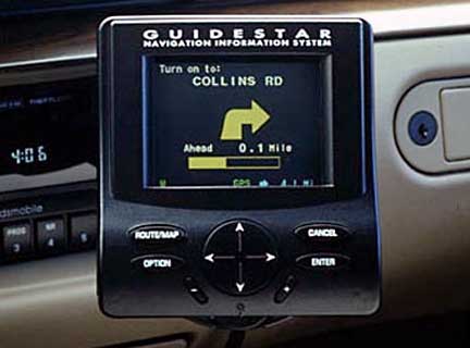
At about the same time, GuideStar, the first in-car GPS, was coming to market as a nearly $2,000 built-in option for the 1995 Oldsmobile Eighty Eight, and the system was pretty primitive by today’s standards. The real breakthrough for drivers was the introduction of affordable portable handheld GPS systems such as Garmin, Magellan, and TomTom that could be mounted to a car’s dashboard or windshield. They only handled turn-by-turn directions at first, but later got maps and 3D views.
Dedicate portable Global Positioning Systems were a great money maker. Unless you are buying on the high end, you maybe pay $150 for the device and then another $49 to upgrade its maps just once – or $99 for unlimited updates. And those fees went right to Garmin, Magellan, or TomTom; nothing was split with the dealer who sold you the hardware, making this very profitable to the GPS makers.
Enter the Smartphone
When smartphones gained GPS capabilities, it was only a matter of time before they had GPS software to rival that dedicated GPS hardware. A portable GPS device usually had a larger screen than a smartphone, but it was often dimmer and less touch sensitive (if our Garmin is any indication). And the GPS really did just one thing, where your smartphone had so many other capabilities.
I’ve been using Waze on my iPhones since Summer 2012, and for the price (free!) it does things our Garmin can never do. The maps are current – no need to download them from the Internet and then install them, only to find that they are already several months (or more) out of date.
Social GPS
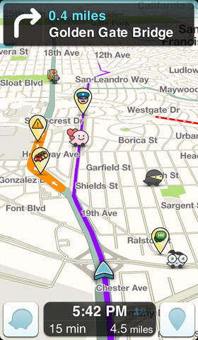
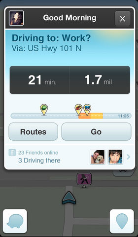
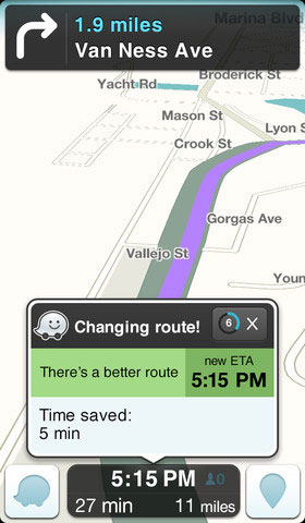
Better yet, Waze leverages the power of 30 million drivers reporting road construction, flooding, accidents, speed traps, and traffic jams in real time. I can’t tell you how often Waze has had me come home a slightly different way to avoid some incident on the highway. It probably does that 2-3 times a month, and not being stuck in traffic makes me happier.
I had one issue with Waze on my iPhone 3GS. There was a short section of highway on the way to work where it would almost always think I had somehow jumped my car onto a road parallel to the expressway, and it was usually 15-20 seconds before it realized I was still on I-196 heading toward downtown. The iPhone 4S has a more accurate GPS module, and that problem disappeared when I upgraded my phone.
You can run Waze in either portrait or landscape orientation, and after experimenting with both, I prefer portrait mode. That’s just the opposite of every dedicated portable GPS I’ve ever seen.
One feature I haven’t used yet is finding the cheapest gas station along my route, but that’s because I know the cheapest ones in the area, other than Costco and Sam’s Club – are within a mile of work. It’s easier to power up Gas Buddy, which has a lot more people reporting prices. But on a trip, Waze should have the edge over Gas Buddy, since Waze knows my route.
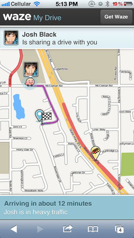
If you’re getting together with friends, you can set up a group and have each member know exactly where the others are en route, which is probably the feature Waze stressed most when it first released it’s app.
If you find mapping errors, you can sometimes note them right from the app, such as “no left turn here”. In other cases, you might find it easier to do that work on your Mac or PC by logging into waze.com.
And It’s Free!
Waze is free, and unlike a lot of free iOS apps, it’s not supported by banner ads. Instead, Waze sells space on its maps to Taco Bell, for instance, so any time there’s a Taco Bell near my route, I see it on the map. I think that’s a great business model and far less intrusive than banners or popups.
Evidently Google agrees. Google recently acquired Waze for $1 billion. Whether Google plans to integrate Waze with Google Maps or keep Waze a separate application remains to be seen, and the deal does have to pass antitrust tests, but I think Google made a brilliant move. If Apple had acquired Waze, only iOS users would be guaranteed a future, but with Google, we know it will be on both dominant smartphone platforms.
Conclusion
I find Waze accurate and very useful, and the ability to avoid construction and accidents is icing on the cake. I find it far more useful than our Garmin and have recommended it to several friends. I’m sure they’ll find ways to make Waze even better, but I can’t find anything wrong with it, so it merits a 5 LEM rating – or 4.5 out of 5 if you have an iPhone 3GS, mostly because its GPS hardware is not as accurate, so it’s not really a reflection of the app but of the app/hardware combination.
Rating: 
Keywords: #gps #waze
Short link: http://goo.gl/hSn1u7

